
The comparison: Chandigarh and Brasília were planned as capitals; Dholera Special Investment Region (DSIR), in Gujarat, India, is planned around industry. Their shared liveability test is whether jobs, homes, services and transport connect to make everyday life workable. [1][2][7]
Two different scales: DSIR’s wider 920-square-kilometre region is distinct from its initial 22.54-square-kilometre Activation Area. The infrastructure status reported for the Activation Area does not describe completion or occupation across the whole region. [7]
A capital born after Partition, a modernist experiment in Brazil and an industrial region in Gujarat ask a shared question: what makes a plan become a place to live?
Chandigarh began with a missing capital. Partition had left Lahore in Pakistan, and East Punjab needed a new seat of government. Dholera begins with a different ambition: to create the infrastructure around which an industrial economy can grow. Separated by decades and purpose, the two projects meet at an everyday question. Once the roads and buildings arrive, what makes people build a life around them? [1][7]
For Chandigarh, the government supplied a founding reason to exist. For Dholera, the proposition centres on production: bringing land, utilities and connections together so businesses can establish themselves. The comparison is useful precisely because their starting points differ. A capital and an industrial region cannot be judged by an identical timetable.
Between them sits Brasília, another attempt to give a national ambition a physical form. Together, these places suggest that the most revealing story of a planned city begins where the master plan meets the ordinary day.
Three planned places at a glance
| Place | Founding purpose | Planning approach | Liveability question |
|---|---|---|---|
| Chandigarh, India | A new capital after Partition left Lahore in Pakistan. [1] | Sectors, a road hierarchy and green spaces for daily needs. [3] | Can residents reach work, schools and recreation in an ordinary day? |
| Brasília, Brazil | A new national capital within a modernisation programme. [2] | Lúcio Costa’s urban plan, residential superblocks and Oscar Niemeyer’s architecture. [2] | Who can live near jobs, and who bears the costs of distance? [6] |
| DSIR, Gujarat, India | An industrial region intended to attract manufacturing and employment. [7] | Serviced industrial land, trunk infrastructure and supporting urban services. [7][10] | Can industrial opportunity connect with affordable homes, schools, healthcare and dependable journeys? |
Why Chandigarh, Brasília and Dholera were planned
Chandigarh’s published history records the search for a site in 1948 and the early planning work of Albert Mayer and Matthew Nowicki, before Le Corbusier became central to the project’s architectural identity. An administrative necessity became an opportunity to express a newly independent country’s confidence in its future. [1]
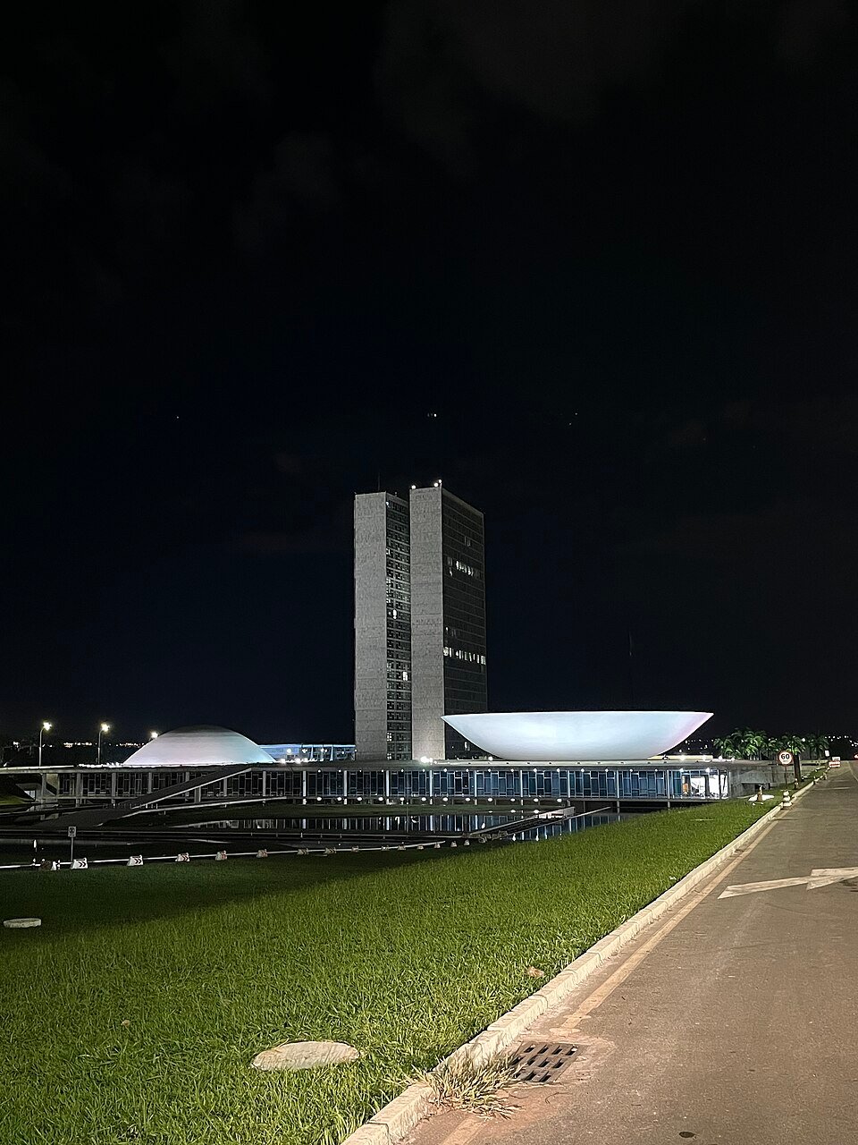
Brasília gave that confidence a different setting. Developed between 1956 and 1960 as part of President Juscelino Kubitschek’s modernisation programme, the Brazilian capital brought Lúcio Costa’s urban design together with Oscar Niemeyer’s architecture. Residential superblocks, administrative spaces and monumental axes formed a coordinated vision of urban life. [2]
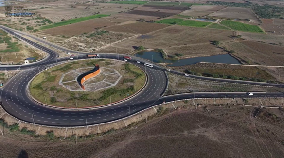
Dholera’s organising idea is industrial. A government can move departments by administrative decision. A manufacturing location must attract an interdependent set of businesses, suppliers and workers. Its urban life depends partly on how those separate decisions connect.
This makes the surrounding city more than a backdrop to a factory. Housing, schools, services and transport enter the calculation of whether people can take up work, bring their families and remain.
“A factory gives people a reason to come. Whether they can stay depends on the life they can afford around it. A technician, a teacher and a small business owner may all need the same city, but they experience its costs and distances differently. For Dholera, the larger question is how industrial ambition connects with housing, schools, healthcare and everyday services across those needs. That is where a manufacturing location begins to acquire the depth of a city: when taking up a job can also mean building a workable family life,” said Megha Choudhary, co-founder of Investor Sathi, a real estate advisory that focuses on opportunities in Dholera.
Housing, jobs and transport: the liveability test
Chandigarh’s planners paid attention to the everyday. The Edict of Chandigarh describes sectors intended to serve residents’ daily needs, with green strips accommodating schools, walking and recreation, and a road hierarchy separating different kinds of movement. These were design intentions, not a measurement of every resident’s experience. [3]
The distinction becomes clear at household scale. A school has an address on a map; a parent has to fit the journey into a working day. A park occupies land; its usefulness depends on who can reach it and when.
Brasília offers a more difficult perspective on the relationship between homes and destinations. A 2022 study in Revista de Direito da Cidade examined the concentration of jobs in the Plano Piloto alongside the relatively small, higher-income population living in that central area. The authors connected the distribution of housing and employment to spatial segregation and access. [6]
Architectural coherence could coexist with an uneven geography of opportunity. The centre’s appearance did not explain the whole city.
For Dholera, this history supplies questions rather than a forecast. How will housing connect to employment? What services will support households? What will it cost, in money and time, to move between them? A transport link or housing proposal can contribute to the answer, but neither settles it alone.
Dholera’s administration is already addressing these needs by developing a school and hospital in preparation for incoming workers and families. A 28 September 2026 government update reported a 200-bed hospital under construction, with completion targeted for December 2026, and a school building ready, with discussions underway to appoint an operator. [10] Bringing education and healthcare into the development programme at this stage recognises that families need more than employment to make a move: they also need places where children can learn and medical care can be accessed.
Dholera’s development milestones: what they establish
Dholera milestones, read with their limits
| Milestone | Reported status | Source date | What it does not establish |
|---|---|---|---|
| Activation Area infrastructure | 22.54 km² Activation Area described as almost complete, with trunk infrastructure established. | 26 February 2026 [7] | Completion or occupation of the wider 920 km² DSIR. |
| Tata semiconductor SEZ | SEZ notification reported; the release lists notification on 9 April 2026. | 16 April 2026 [8] | Chip production, commercial operation or a settled surrounding workforce. |
| 200-bed hospital | Under construction; completion targeted for December 2026. | 28 September 2026 [10] | An operational hospital or care already available. |
| School | Building reported ready; operator discussions underway; completion targeted around October 2026. | 28 September 2026 [10] | That the school has opened, appointed an operator or admitted pupils. |
The scale of Dholera makes precise language essential. A Press Information Bureau backgrounder dated 26 February 2026 describes the Dholera Special Investment Region as spanning 920 square kilometres. It separately identifies a 22.54-square-kilometre Activation Area, which it describes as almost complete, with trunk infrastructure established. [7]
The wider region and that initial development area are different geographies. Infrastructure progress within one cannot be read as completion or occupation across the other.
In April 2026, the government announced the notification of a Special Economic Zone for Tata Semiconductor Manufacturing Private Limited at Dholera. That establishes a specific administrative milestone. The notification itself does not establish production or a settled surrounding workforce. [8]
Read together, the records explain why Dholera belongs in a discussion of planned cities: an industrial purpose is being given a physical setting. They also show why each stage needs its own evidence. Approval, construction, operation and everyday urban life describe different achievements.
“When we look at Dholera, it helps to ask two questions separately: what has been built, and what does it enable people to do? A road is a physical asset; a dependable journey to work is an outcome. A serviced industrial plot creates a possibility; an operating business shows how that possibility is being used. These distinctions help us recognise progress precisely. An emerging place needs room to develop, while each milestone needs to be understood on its own terms, without making it stand for everything that may follow,” quipped Choudhary.
That second question connects the industrial story back to the experience of a city. It asks about the usefulness of infrastructure without assuming either success or failure.
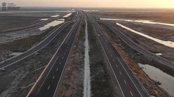
What Dholera can learn from Chandigarh and Brasília
Older planned cities also reveal how much can change beyond an original boundary. Chandigarh’s Master Plan 2031 acknowledges that urban uses had extended into its periphery and that restoring the initial city–periphery arrangement in full was no longer realistic. The plan had to respond to the place that had developed around it. [4]
Its treatment of villages adds another layer. The document calls for respect for their character and the preservation of community spaces, old groves and water bodies where relevant. A new urban project encounters histories that precede its own. [5]
For an emerging region such as Dholera, the comparison suggests a broader way to read development. Alongside the new infrastructure, there are questions about existing settlements, changing needs and the institutions that will manage growth. Those questions require evidence in their own right.
The World Bank’s Planning, Connecting, and Financing Cities—Now treats land use, services, access and infrastructure finance as connected responsibilities. Its concern is with choices that can lock cities into arrangements that are difficult to change. [9]
The implication is practical. A road, a neighbourhood and an employment centre need to work in relation to one another. Planning remains relevant long after their locations have been drawn.
Chandigarh answered an urgent need for a capital. Brasília gave a national project an urban form. Dholera seeks to organise the conditions for an industrial economy. Their different histories bring us to a shared test of city-making: when does a place planned for the future become somewhere people can choose to make a life?
Sources and reading
[5] Chandigarh Administration, Chandigarh Master Plan 2031, Villages, proposals, printed pp. 367–369.
Related reading
Explore Ashima’s The Country Between Two Speeds for another perspective on infrastructure, ambition and the human measure of progress.
For the relationship between urban design and everyday comfort, read Built for Yesterday’s Weather.
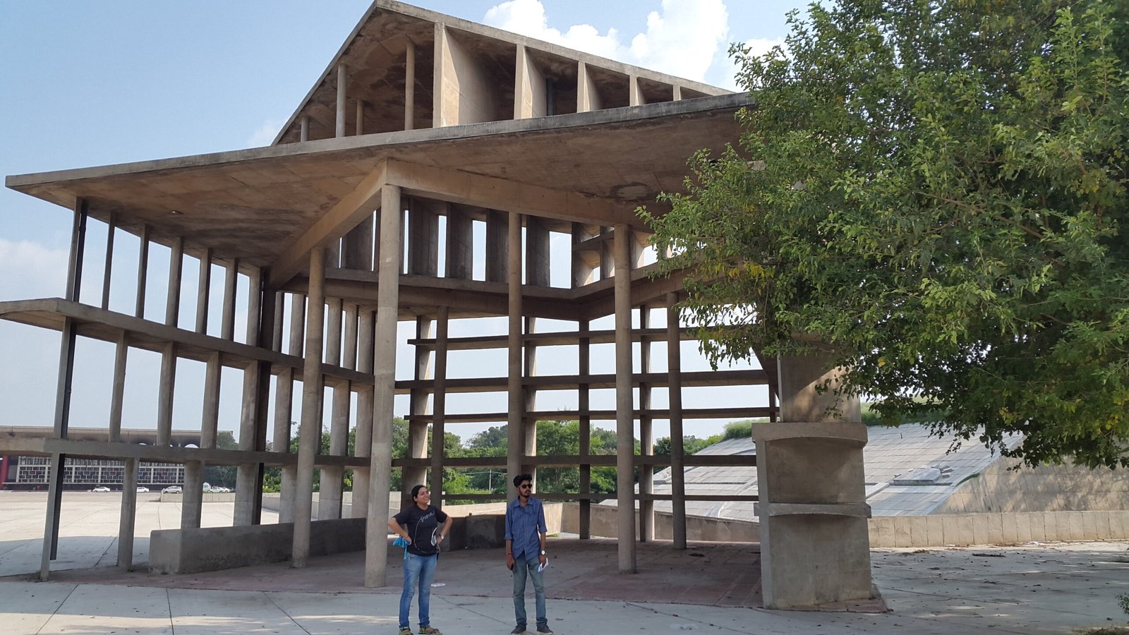
Featured photograph: Tower of Shadows, Capitol Complex, Chandigarh. Photo: Lillottama / Wikimedia Commons, CC BY-SA 4.0. Resized for display.